One map
OpenStreetMap and OpenSeaMap in a clear, modern app.
In development
Marine navigation for iPhone and iPad
Rivers & Seas brings nautical charts, the places that matter to you, live vessel traffic, and data from your boat into one calm, readable marine navigation app.
Available as a public beta for iPhone, iPad, and Apple Watch. Mac is coming next.
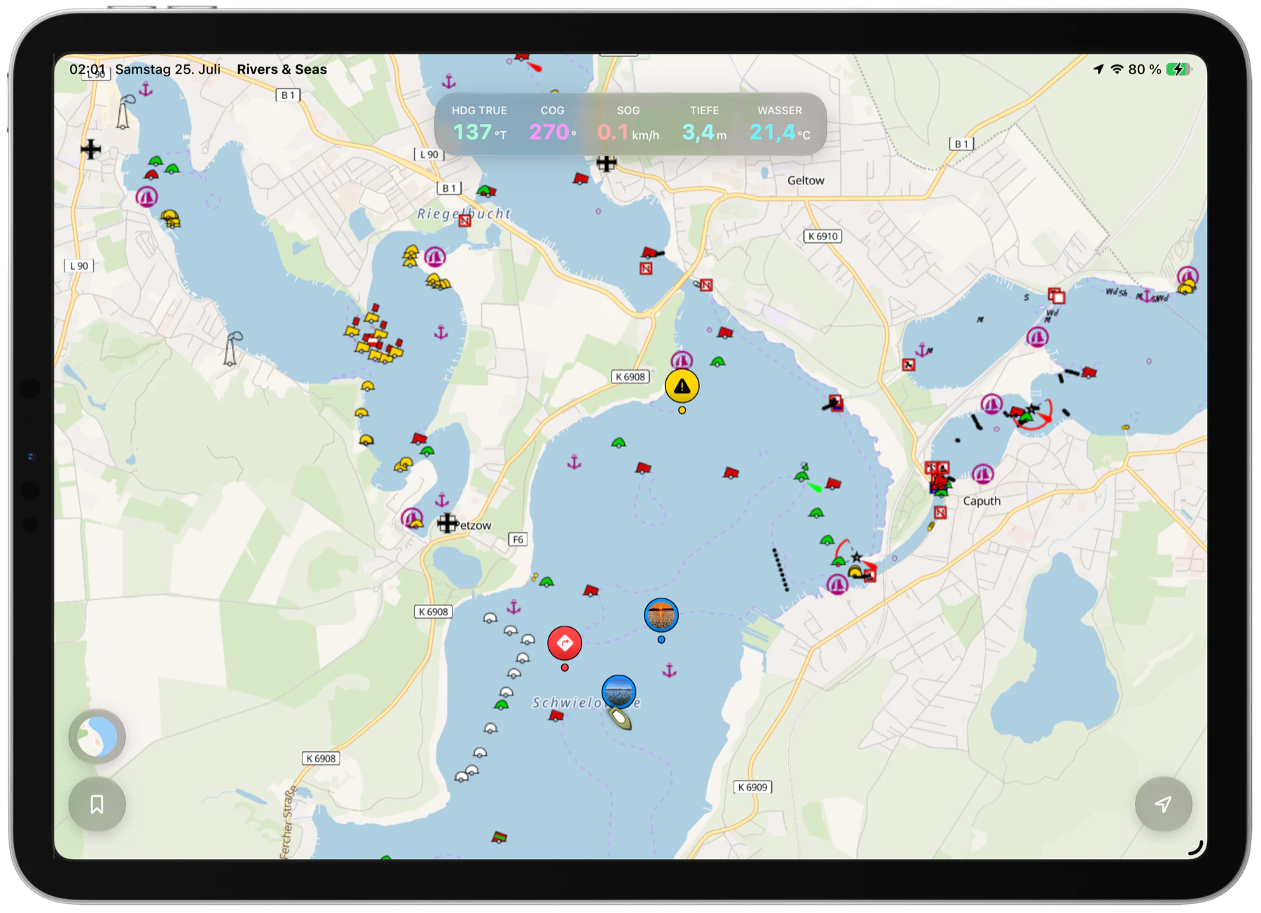
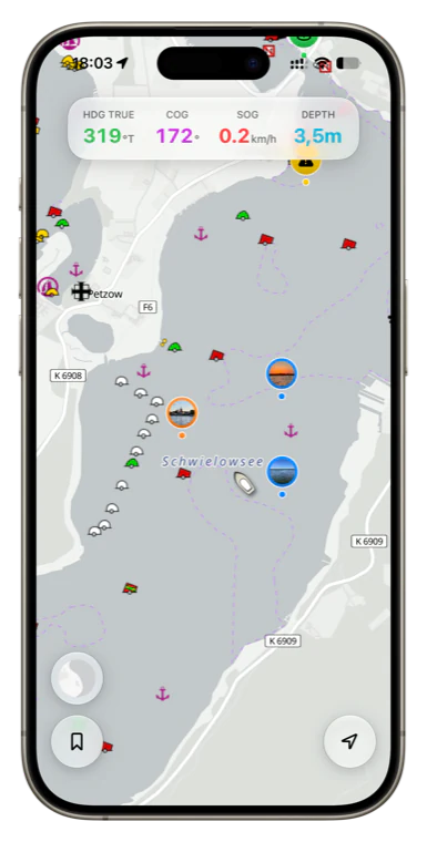
OpenStreetMap and OpenSeaMap in a clear, modern app.
Return to anchorages, harbors, warnings, and discoveries.
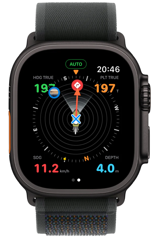
Course, speed, depth, and more directly on the map.
Try the map for yourself
Move and zoom the map just as you would in Rivers & Seas. Use the round map button to switch between the bright map, the automatic day-and-night map, Seascape with water depths, and satellite imagery. OpenSeaMap navigation marks remain visible in every view.
Tap a place to mark it and share it as a link.
Nautical charts and water depths
Use OpenStreetMap on land and OpenSeaMap navigation marks on the water. Along the coast, Rivers & Seas adds depth shading, depth contours, and spot depths.
Switch at any time between a calm everyday map and the coastal map with water depths.
Explore OpenSeaMap in Rivers & Seas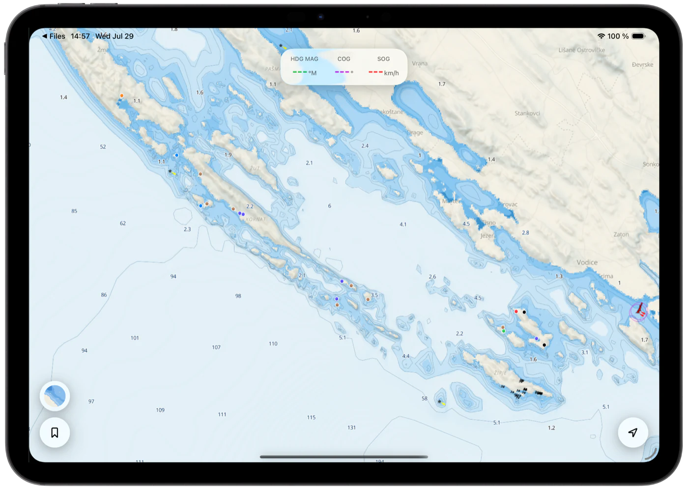
Ship radar and AIS
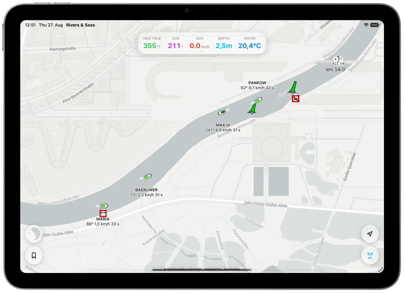
What is coming around the bend? What is the commercial vessel ahead called? How busy is the bay? The Rivers & Seas ship radar shows available live AIS traffic with names, direction and speed alongside your boating map.
Your route, local information and AIS stay in one app, with less searching and switching underway.
Discover AIS in Rivers & Seas
Places that matter to you
Save favorite anchorages, restaurants, supplies, or navigation notes. Add photos and notes, organize everything with tags, and show only the places you need right now.
Let your photos do the work: select the best pictures from a trip together. Rivers & Seas sorts them by place and turns them into the right bookmarks. Turn photos into favourite places
Your bookmarks stay together across iPhone, iPad, Apple Watch, and later Mac.
See what bookmarks can doYour boat data
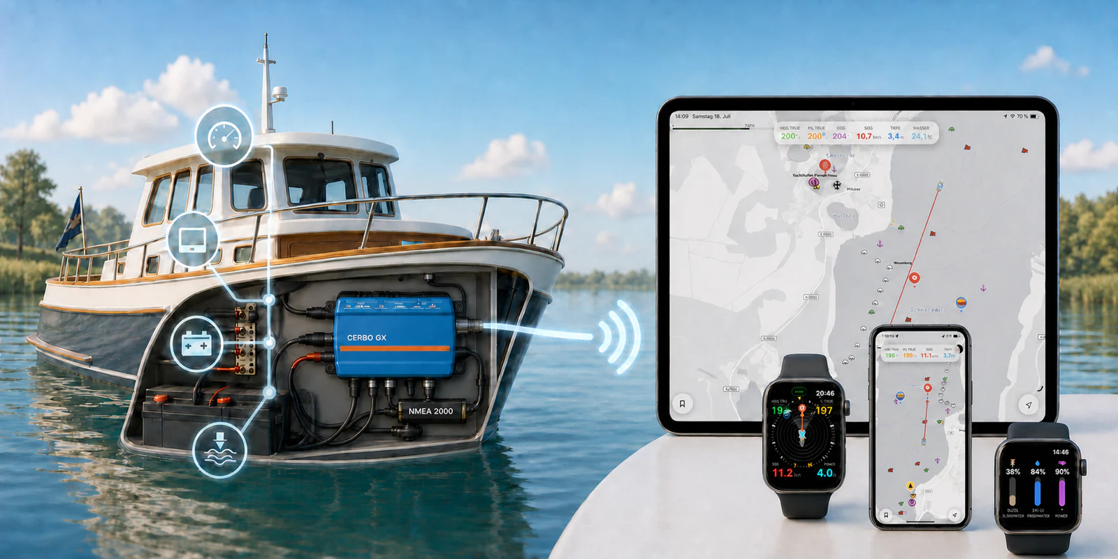
Rivers & Seas can display Signal K data from your onboard network, including course, speed, water depth, temperatures, and tank levels. With a compatible setup, you can even control the autopilot from iPhone, iPad, or Apple Watch.
Connect boat data with Signal KWithout a connection to your boat, Rivers & Seas remains a complete map and bookmark app.
If your iPad has no built-in GPS, Rivers & Seas can use the accurate position from your iPhone instead. Use your iPhone’s position on iPad
For your Apple devices
Plan in comfort, take the map aboard, and keep essentials in sight while underway.
Your map and places are always with you.
More room at the helm and while planning.
Course, boat data, and nearby bookmarks on your wrist.
Prepare routes and places on a large screen in the future.
Learn more
Navigation marks, coastal water depths, and a useful everyday map.
OpenSeaMap in Rivers & SeasStep-by-step help, from your first bookmark to Signal K.
Browse all guidesBranded routes, places, and recommendations for charter operators.
For charter companiesAvailable now as a public beta
Install Rivers & Seas free through TestFlight. Try it on your waters and help make it even better by sharing your experience.