What is coming towards me?
Spot commercial traffic and leisure boats before a bridge, bend or narrow stretch, wherever current AIS coverage is available.
Ship radar for boats
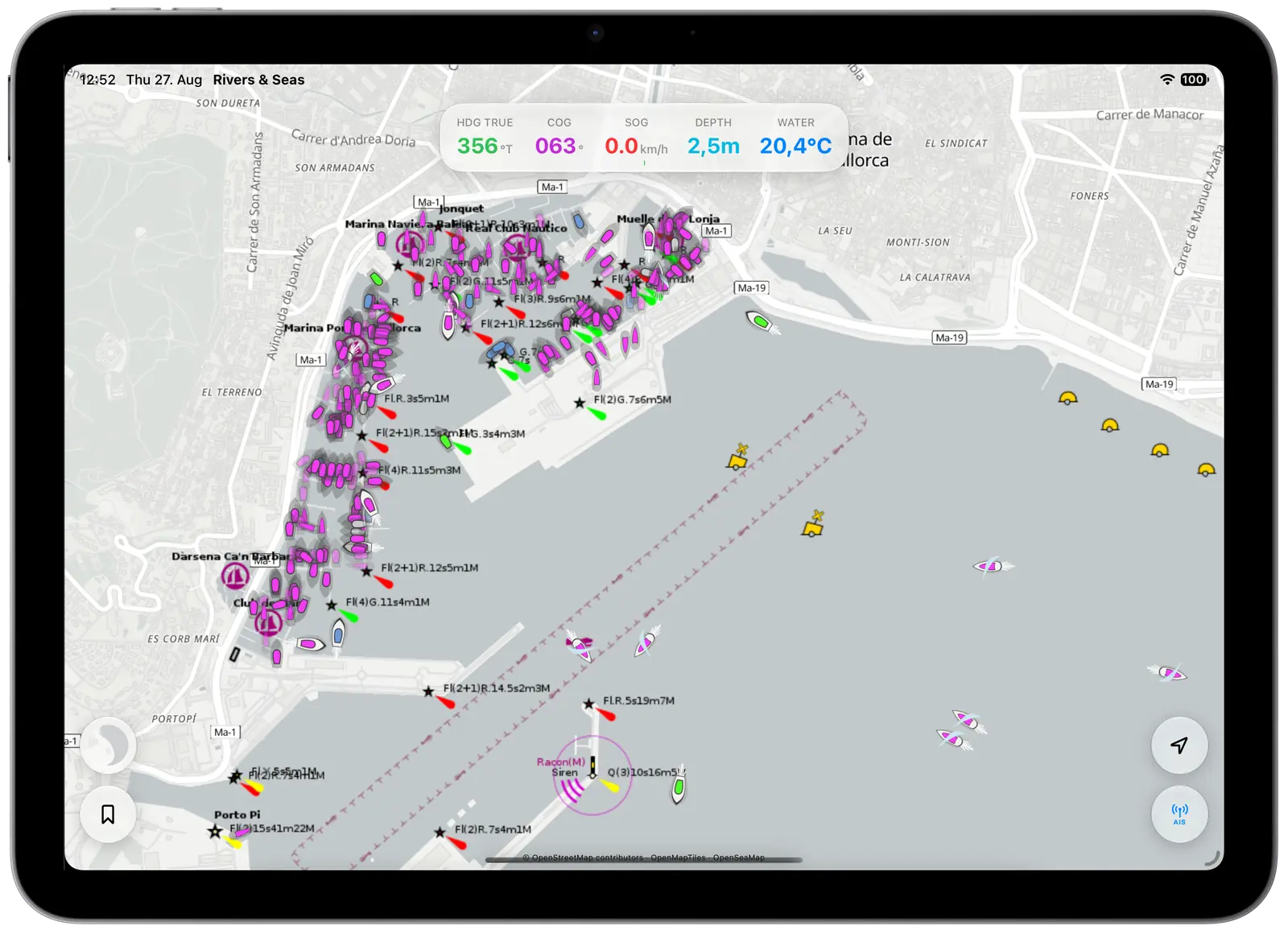
With the Rivers & Seas ship radar, you see live AIS traffic directly on your boating map, with names, direction and speed. Your route, local information and AIS stay together instead of being split across several apps.
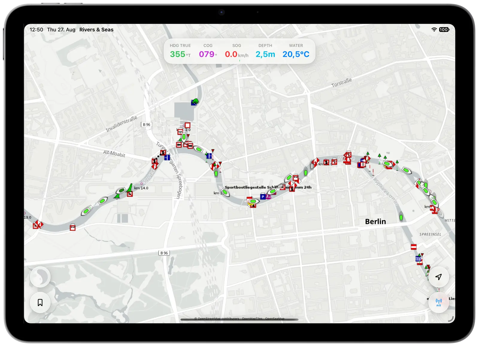
Live vessel traffic at a glance
A quick glance at the map helps you understand what is happening ahead.
Spot commercial traffic and leisure boats before a bridge, bend or narrow stretch, wherever current AIS coverage is available.
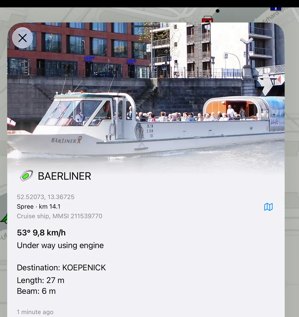
Tap a vessel to see its name, useful when you want to call it directly over the radio.
See whether commercial traffic is ahead of you or approaching from behind, and judge the wait with more confidence.
Check how lively a bay or harbour appears before entering – and whether friends with AIS have already arrived.
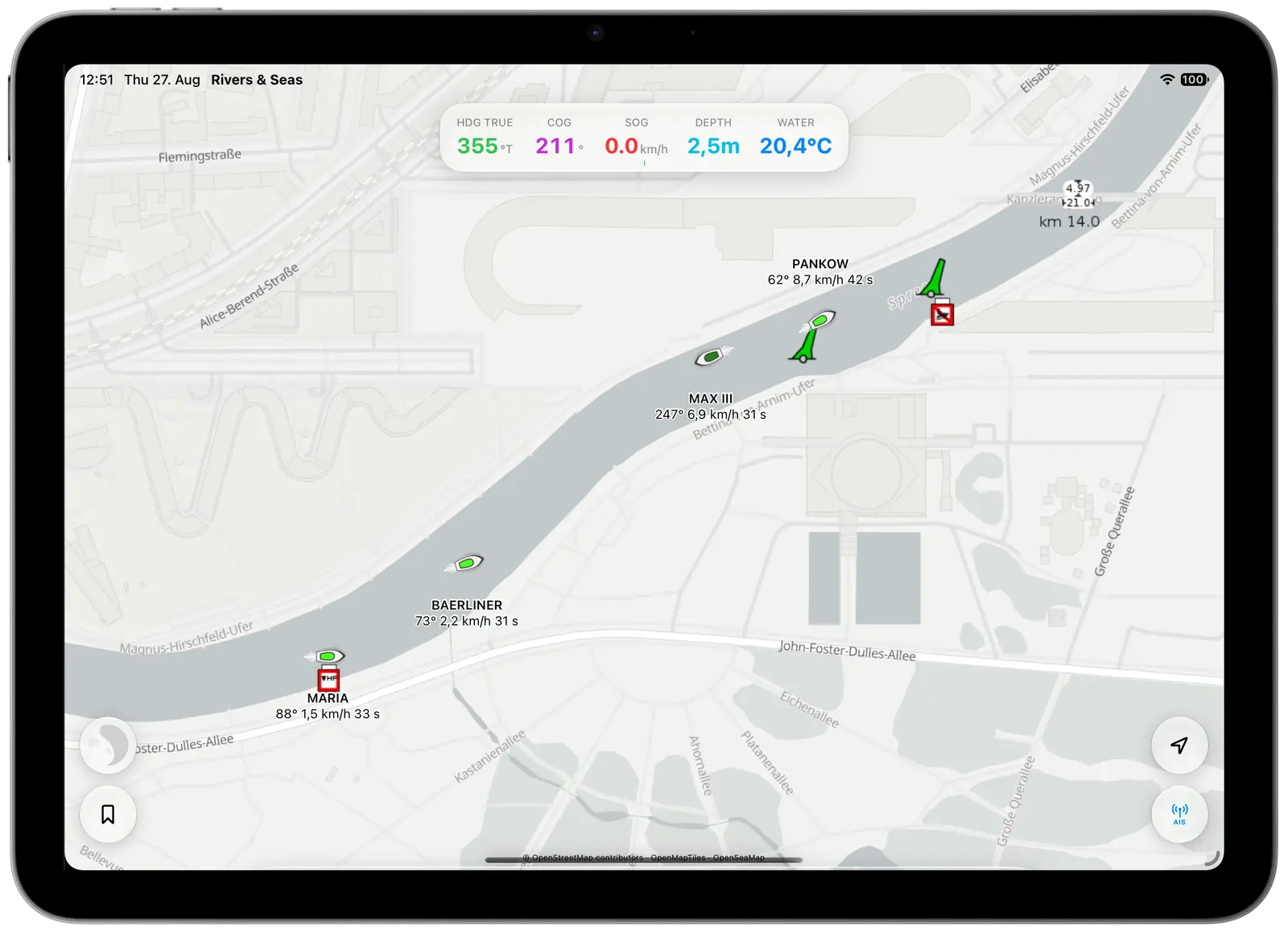
One app instead of three
A day on the water can mean planning in one app, searching local notices elsewhere, then opening a separate AIS app. Rivers & Seas brings the useful parts together on one map. There is less tapping and switching when your attention belongs outside the boat.
Land, water, navigation marks and important places remain the foundation of your trip.
AIS targets appear in context on the same map whenever coverage is available.
Names, direction, speed and other available information are close at hand.
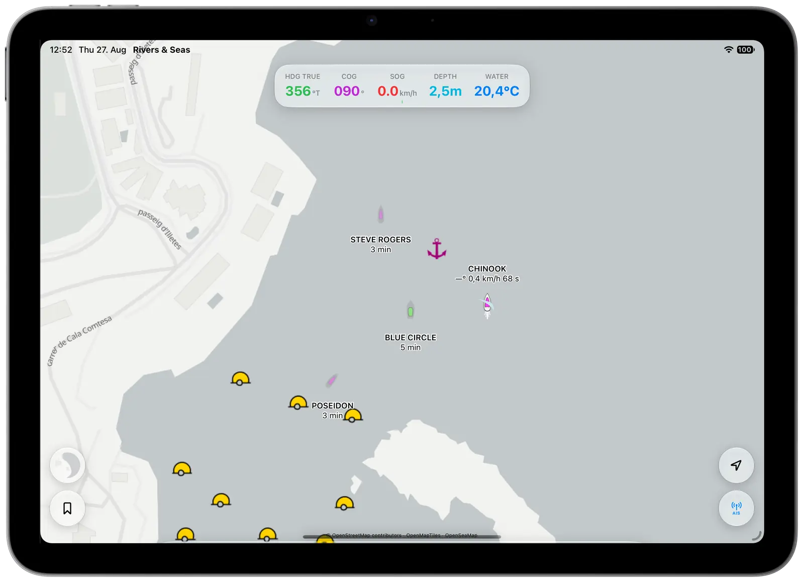
From river bends to busy bays
On a river, AIS lets you look ahead. In a bay, it gives you a sense of how many boats are already anchored. Near a harbour, it helps make vessel movements easier to understand. Rivers & Seas uses available online AIS coverage automatically, and can also connect to your own onboard receiver.
The practical AIS guide explains what the vessels mean, how current the information may be, and how to connect your own onboard AIS receiver.
Read the plain-language AIS guideSee more. Switch less.
Rivers & Seas is available as a public beta for iPhone and iPad. Try the boating map with AIS in your area.