
Six questions AIS can answer while you are out
AIS is most useful when it helps you make a decision. Instead of studying a long list of vessel data, use the map to answer practical questions.
What is coming through the narrow section?
Before a bridge, bend, or narrow passage, you can see whether a vessel is approaching and how quickly it is moving.
What is the vessel ahead called?
Tap the vessel. Its name lets you call it directly on the radio instead of hailing an unidentified vessel ahead.
Might I share the next lock?
A commercial vessel ahead or astern is a useful clue to when the lock may operate next, helping you pace your journey.
How busy is the bay?
Before you enter, you can get a feel for how many boats are there and whether it is worth looking for a quieter spot.
How busy is the harbour?
The map shows how many boats are alongside and where vessels are moving. Not every boat transmits AIS, but the overview still helps.
Where are my friends?
If your friends’ boat transmits AIS, you can find it by name and see whether they are still underway or have arrived.
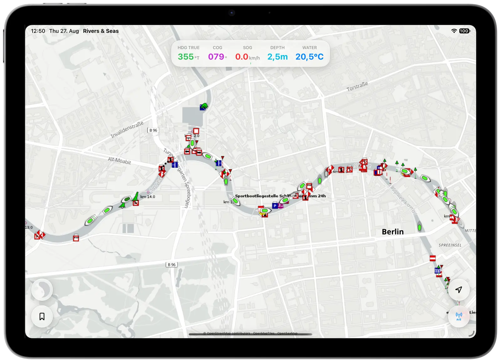
Know sooner at narrow passages and locks
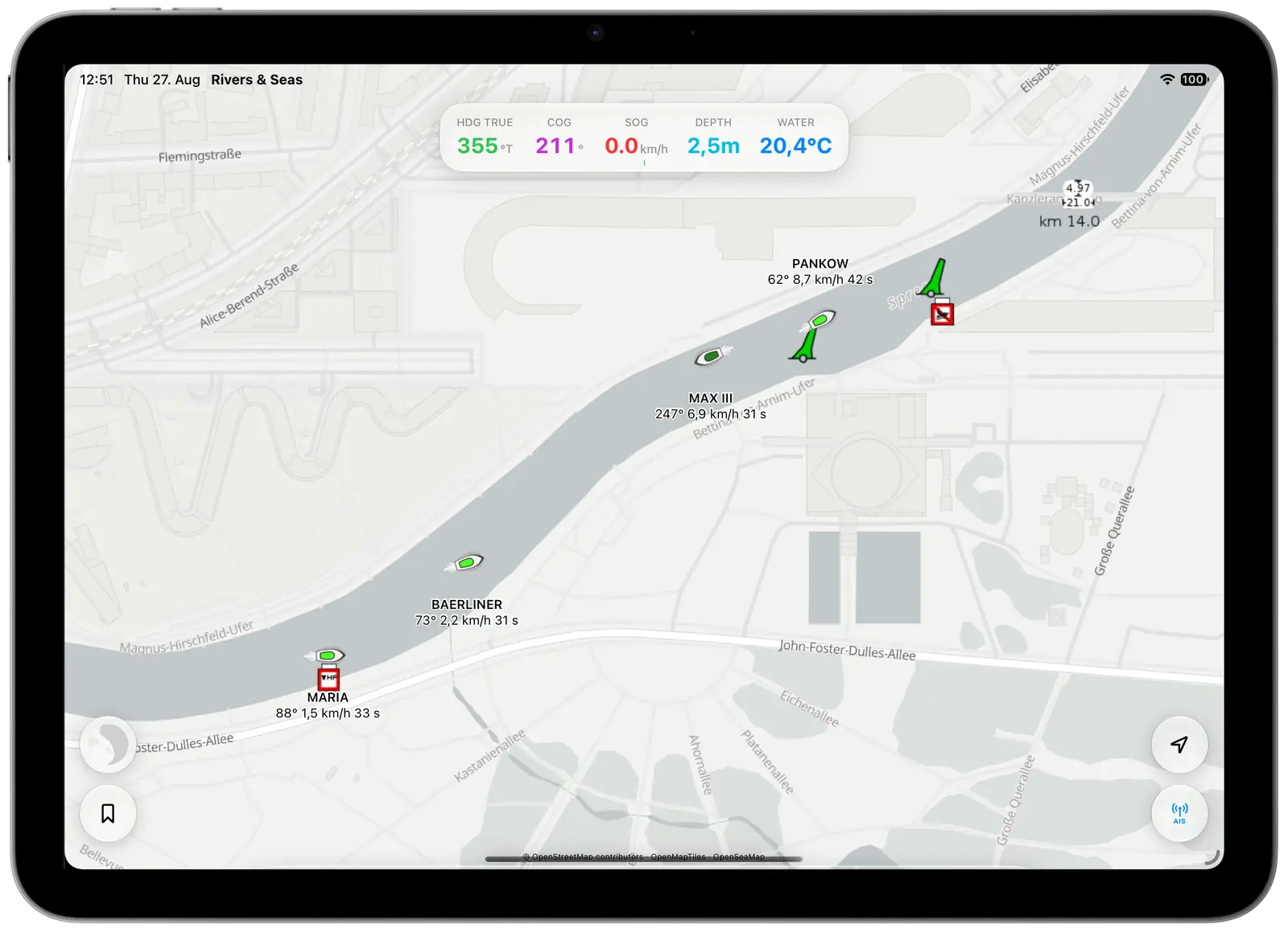
Zoom in on the bridge, bend, or lock approach. The pointed end of the vessel symbol shows its direction. Beneath the name, you see course, speed, and the age of the position.
This makes it easier to tell whether a passenger vessel is approaching or travelling ahead of you. When a commercial vessel is bound for the lock, you can judge whether sharing its locking is realistic without accelerating on guesswork.
Tap a vessel when you need its name for a radio call or want to see more information.
See occupancy and familiar boats in a bay
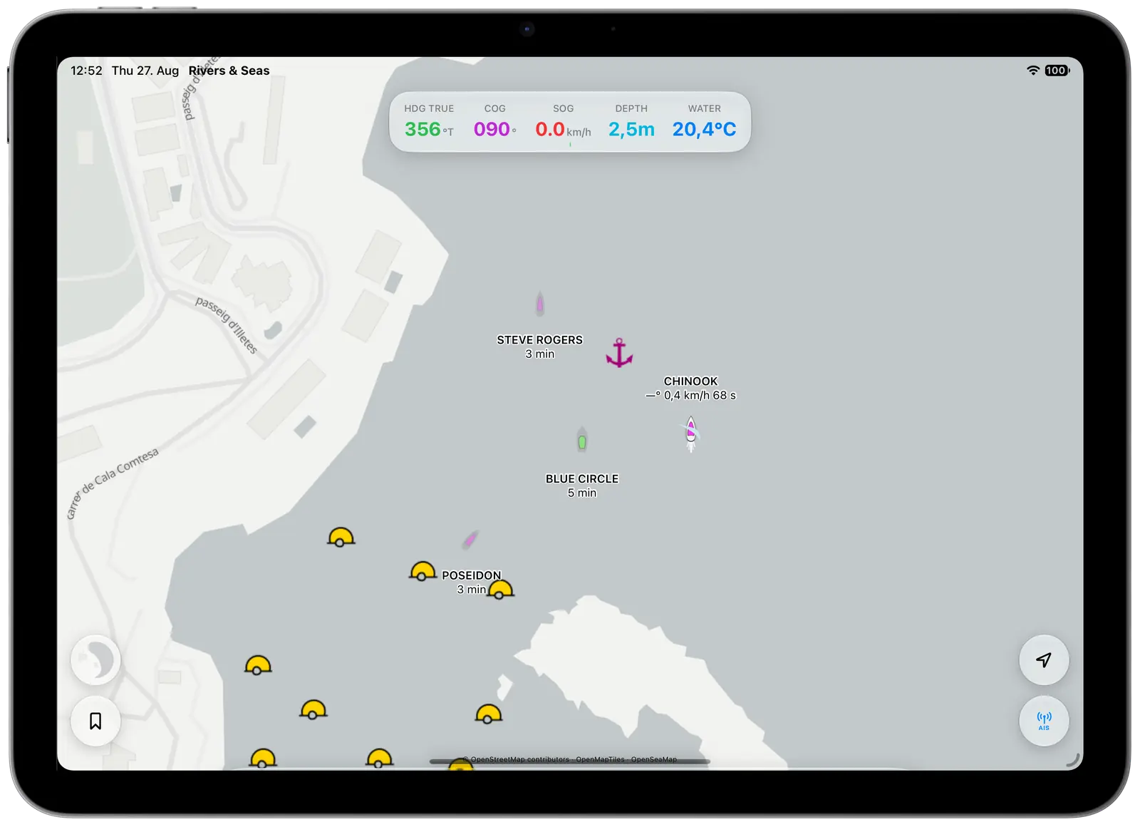
Before you arrive, the map shows where boats are gathered and which parts of the bay look quieter. A name beside a symbol makes a familiar boat easy to find.
Remember that many smaller leisure boats do not carry an AIS transmitter. The map provides a useful picture, but it cannot show every boat that is actually there.
Get an initial overview before entering a harbour
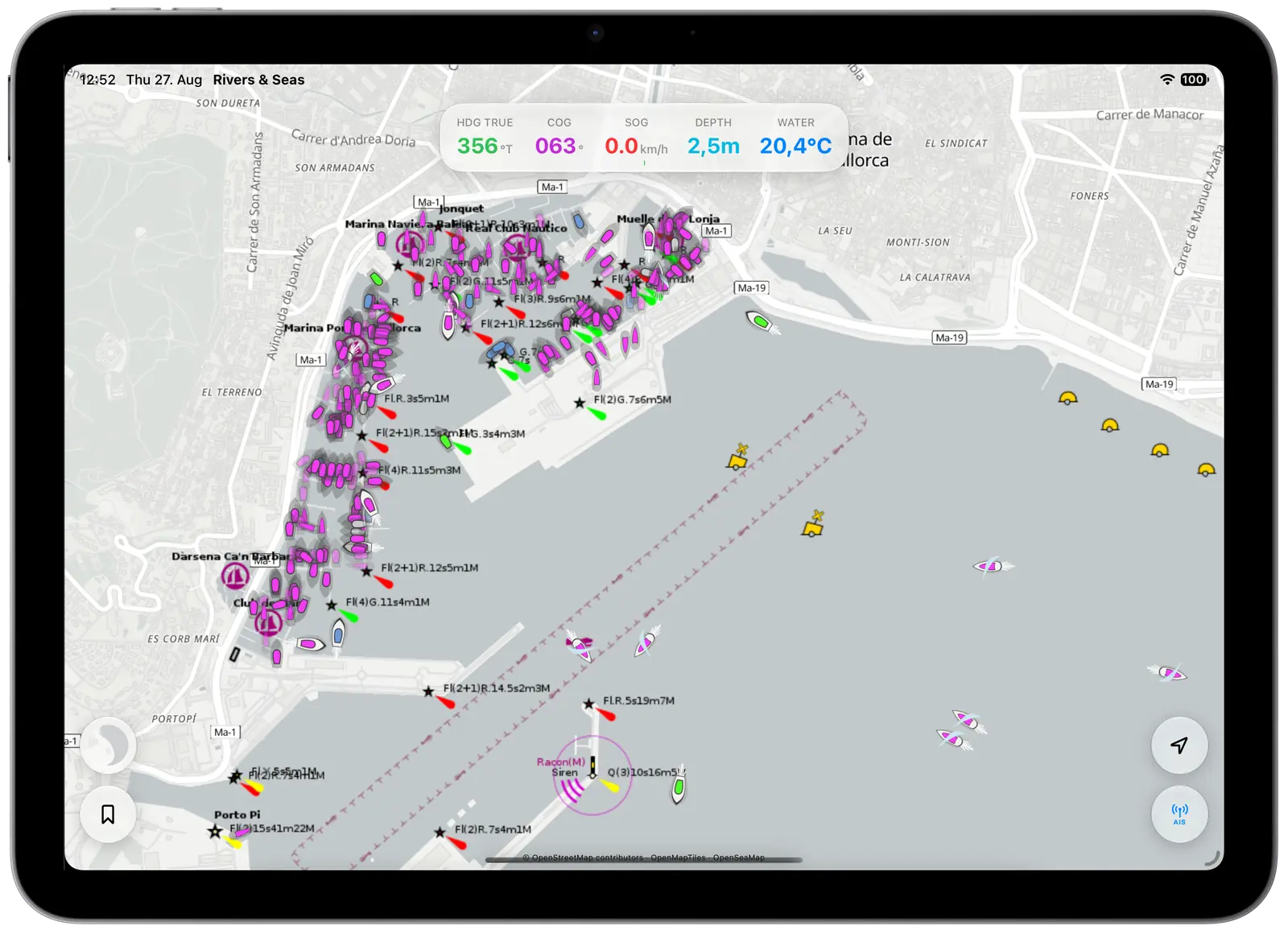
A glance at the harbour shows whether many boats are alongside and whether vessels are moving near the entrance. It does not replace asking for a berth, but it can help you decide whether to enter directly or call first.
Zoom in far enough for the individual symbols and names to become clear.
Tap a vessel for the useful details
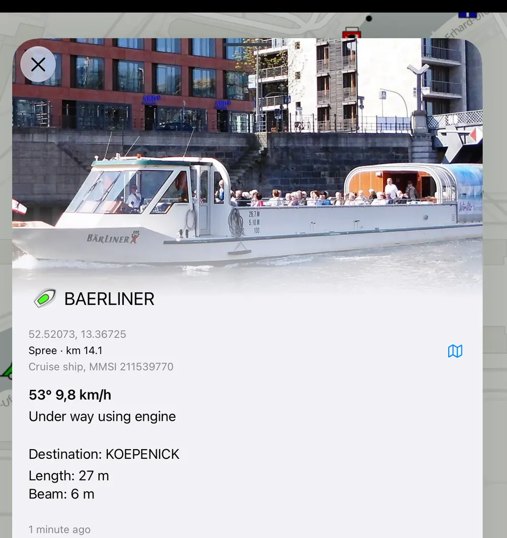
The detail view starts with the vessel name. When a suitable photo is available, it often helps you recognise the vessel. Below that are its position, waterway or river kilometre, vessel type, direction, and speed.
Commercial vessels may also provide destination, length, and beam. The age of the latest position appears at the bottom. Not every vessel sends every field, so missing lines are normal.
How to read vessel symbols and colours
The shape points in the vessel’s reported direction. A bright vessel with a white edge is underway; a darker symbol is stationary or has not reported that it is underway. An anchor means the vessel has reported that it is at anchor. A faded symbol marks an older position.
The inner colour represents the reported vessel type. It is not a warning level.
Magenta
Sailing boats, motor yachts, and other leisure craft.
Green
Passenger and cargo vessels, including trip boats and commercial traffic.
Orange
Tankers.
Light blue and blue
Fishing vessels and other working or specialist craft.
Yellow
High-speed craft.
Red
Rescue vessels and special emergency signals.
Grey
The vessel type is unknown or was not reported.
How to read AIS aids to navigation
Rivers & Seas can show aids to navigation that report their position through AIS as well as vessels. These may include buoys, beacons, and lights, and are often shortened to AtoN.
The magenta diamond is not another boat. Tap it to see the aid’s name, type, reported position, and the age of the report.

Standard aid
A solid diamond marks an aid to navigation reported at its expected position.

Virtual aid
The dashed diamond with a V marks a transmitted position only. There may be no physical buoy or beacon at that spot.

Off station
The red ring warns that the aid is reported away from its expected position. Keep clear and open the details.

Mobile aid
The arrow marks an aid that can move. When a direction is reported, the arrow points that way.

Warning
The warning triangle marks reported damage, displacement, removal, or another abnormal condition. Tap the symbol for the exact status.
Always check the age of the position
Beneath the vessel name you may see “31 s”, “3 min”, or “1 h”. This is the time since the latest received position. Moving vessels commonly update within seconds. Stationary boats may report less often, and an internet connection can introduce extra delay.
Rivers & Seas displays a vessel normally for about three minutes. It then fades because its real position may have changed. After about 15 minutes, it disappears from the map.
The narrower the passage and the faster the vessel, the more important a recent position becomes. Keep looking outside and do not make collision-avoidance decisions from internet data alone.
Why you may see no vessels in some regions
First, zoom in. Rivers & Seas hides AIS from large-area views to keep the map readable. Also check that your iPhone or iPad currently has internet access.
Internet coverage varies by country, coast, and inland waterway. Some areas provide many reports, while others provide few or none for a time.
Not every boat transmits AIS. Smaller leisure craft in particular may not be equipped or may have their transmitter switched off. A receiver aboard only sees vessels within radio range; shorelines, buildings, aerial height, and the installation aboard all affect that range.
Connect your own AIS receiver aboard
Your own receiver shows vessels directly from the surrounding area and can work without an internet connection. It must make its data available on the boat’s Wi-Fi, and your iPhone or iPad must be connected to the same network.
Have the details from the receiver’s instructions or settings page ready: connection type, address, and port. You do not need to invent these values.
- On the map, tap the round antenna button marked “AIS” at the lower right.
- Turn on “Use direct AIS receiver”.
- Choose TCP when the receiver provides an address or host name. Enter that address and the stated port.
- Choose UDP when the receiver sends its data to the iPhone or iPad. Enter only the stated port.
- Tap the tick at the upper right. Vessels appear automatically as soon as data arrives.
If the map stays empty, first check the shared Wi-Fi, the “Use direct AIS receiver” switch, the entered values, and the Local Network permission for Rivers & Seas. Then check that data output is enabled on the receiver.
What AIS is and how vessels reach your map
AIS is a radio system through which equipped vessels transmit information such as their name, position, direction, and speed. Other vessels and receiving stations can pick up those reports.
Aerials around the world collect these reports and make them available over the internet. Rivers & Seas displays the vessels received there on your map.
Your own AIS receiver aboard can also receive vessels in the surrounding area directly. Rivers & Seas adds them to the same map and combines them with the other reports, so the same vessel does not appear twice.
AIS supports a proper lookout, radio communication, and good seamanship. It can only show vessels from which a sufficiently recent report has actually arrived.