When will I get there?
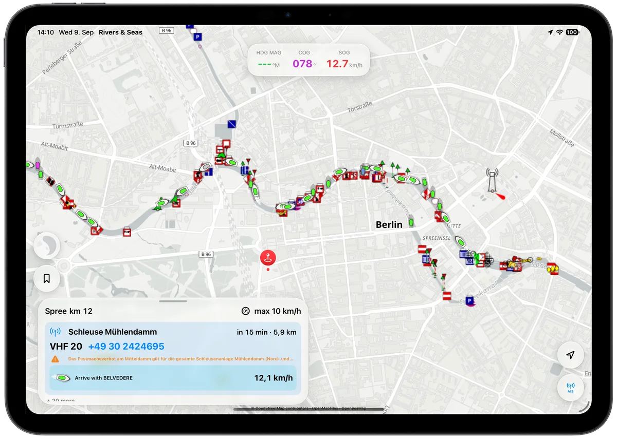
The estimated arrival appears directly beside the objects ahead.
Boat navigation without compulsory route setup
You look for a boat route planner because you want to know when you will arrive, whether your boat will fit, and whether the lock will be open. Rivers & Seas answers those questions automatically on the waterway you are actually cruising—without entering a start, destination, or waypoints first.

What you really want from a boat route planner
On rivers and canals, the way is often clear already. What matters underway is which bridge, lock, closure, or encounter lies ahead—and when you will reach it. Rivers & Seas handles that work automatically.
The estimated arrival appears directly beside the objects ahead.
Known boat dimensions, clearances, and available water levels can become a warning before space gets tight.
Operating times, closures, and notices are related to your arrival.
AIS traffic is interpreted in the context of the waterway.
The decisive difference
Both can be useful. But a navigation app should not require you to build a route before it can help you underway.
Automatically ahead instead of searching afterwards
Rivers & Seas follows position, direction, and speed. The result is a continuously updated look ahead with arrival times—and, on supported iPhones, alerts even while the screen is locked.
Bridge clearance, lock time, and tide matter at the moment you will actually be there.
Available navigation notices are connected to the waterway and shown as useful information or warnings.
A large vessel around the bend or a crossing ferry becomes part of the situation ahead.
And when you really do want to plan?
A conventional route planner makes sense for a long holiday cruise, comparing cruising areas, or building a detailed day plan. That kind of planning is intended for Rivers & Seas. Underway, automatic look-ahead remains the important part: it follows the journey you are actually making, not only yesterday’s plan.
One app for inland and coastal cruising
Inland, bridges, locks, and notices ahead take centre stage. Along the coast, OpenSeaMap marks, depths, satellite imagery, and AIS work together.
No route-planner subscription
The public beta is free. The finished app is planned at one fixed purchase price for every feature and cruising area, with no monthly or annual fees.
Try it yourself
Install the free public beta, or first try the browser map with real AIS targets.