Bridges
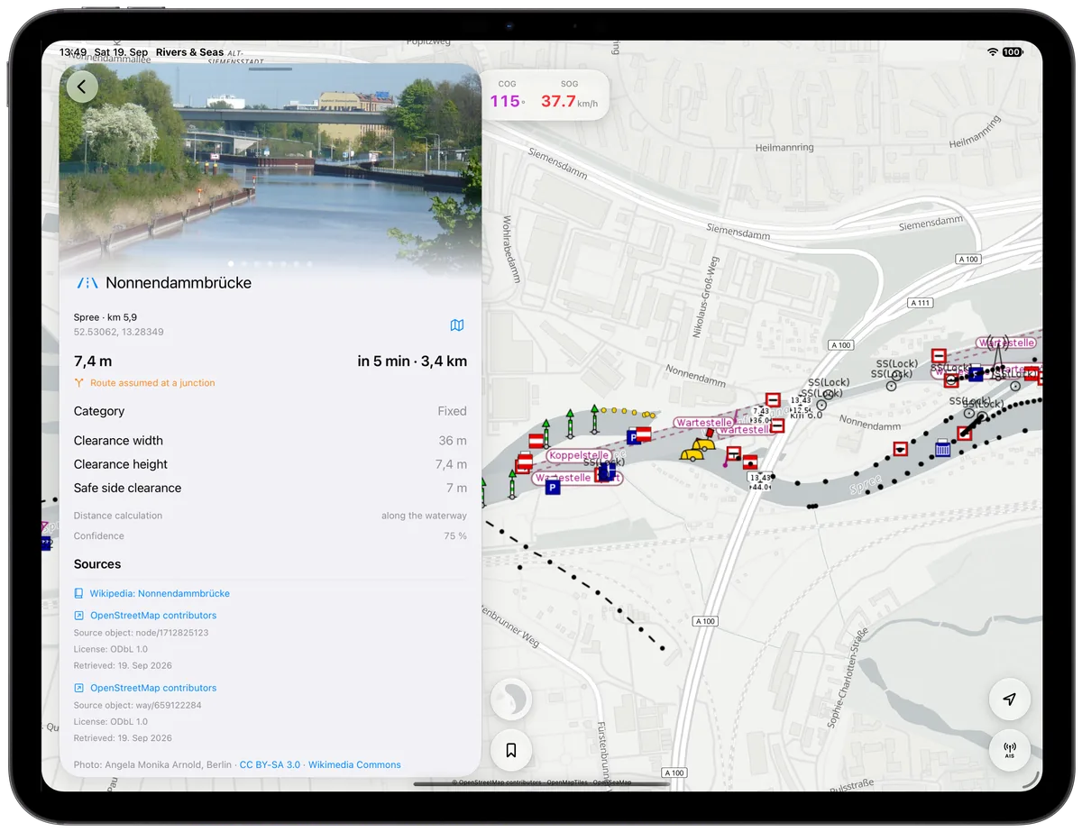
Photo, dimensions, and available clearance at your estimated arrival.
Waterway Ahead—automatically
There is no route to plan and no information to assemble. Rivers & Seas recognizes the waterway as you cruise and automatically shows bridges, locks, notices, and vessel traffic in the order that they matter.
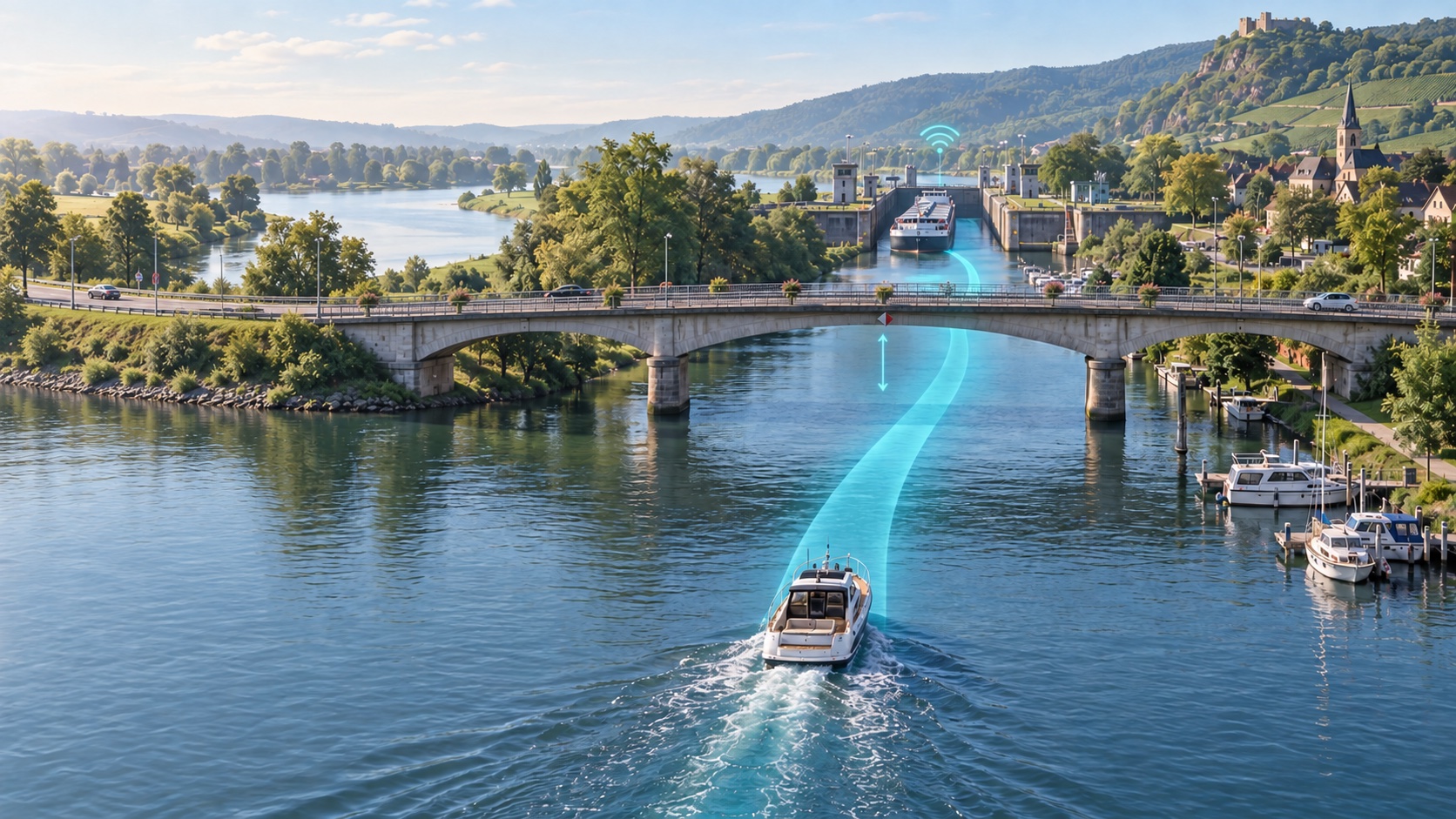
Set off instead of planning ahead
Your position, direction, and speed are enough. The view keeps updating and brings forward what you will reach next. Turn onto another waterway or change speed, and Rivers & Seas automatically adjusts the order and arrival times.
Photo, dimensions, and available clearance at your estimated arrival.
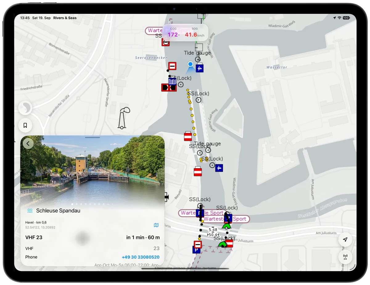
Operating time, closure, VHF, and telephone details before you reach them.
Commercial vessels, ferries, and oncoming traffic in the context of the waterway.
Arrival, not static data
Rivers & Seas combines boat dimensions, current speed, tide height, opening times, and available navigation notices. Many separate facts become one clear answer: Will the bridge fit, will the lock be open, and what traffic lies ahead?
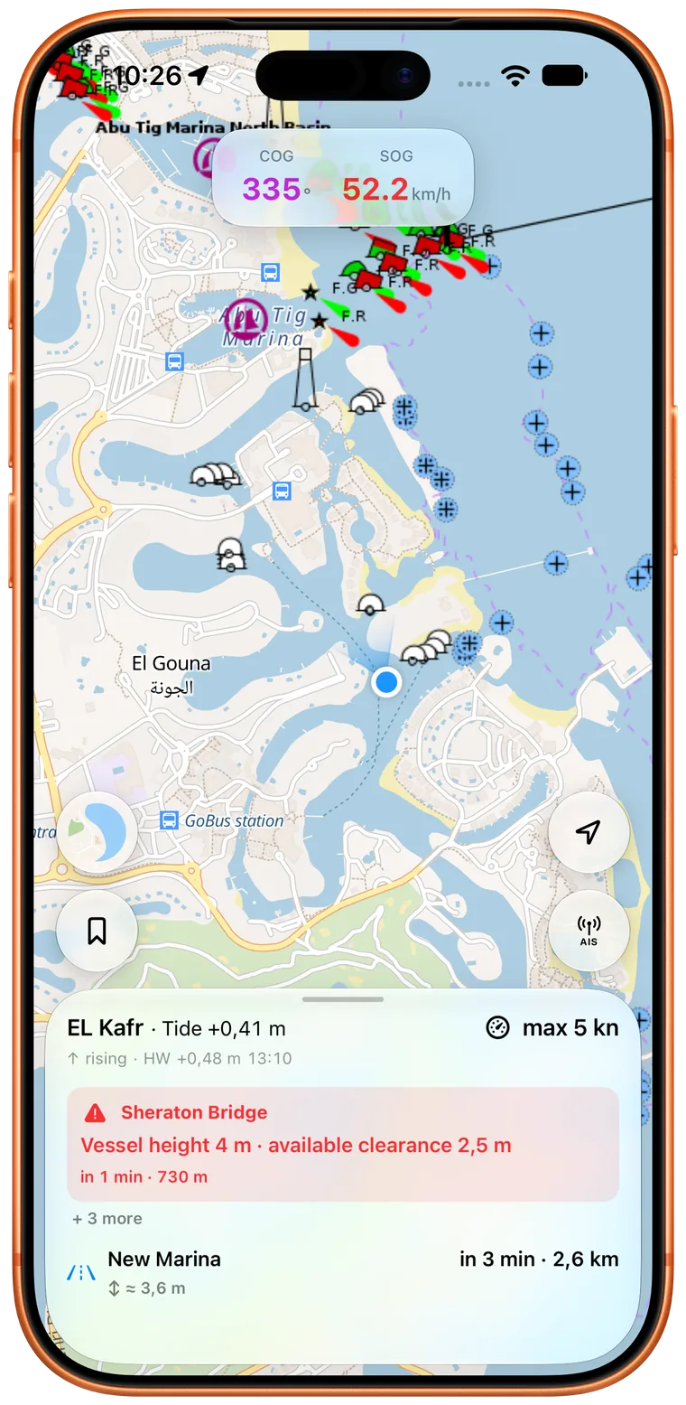
Where tides or water levels are available, the clearance expected when you reach the bridge is what matters.
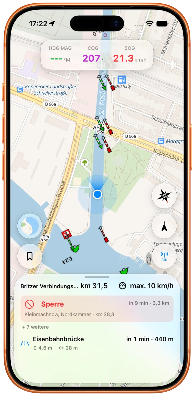
Operating times, closures, and notices relate to your arrival instead of sitting in a separate list beside the map.
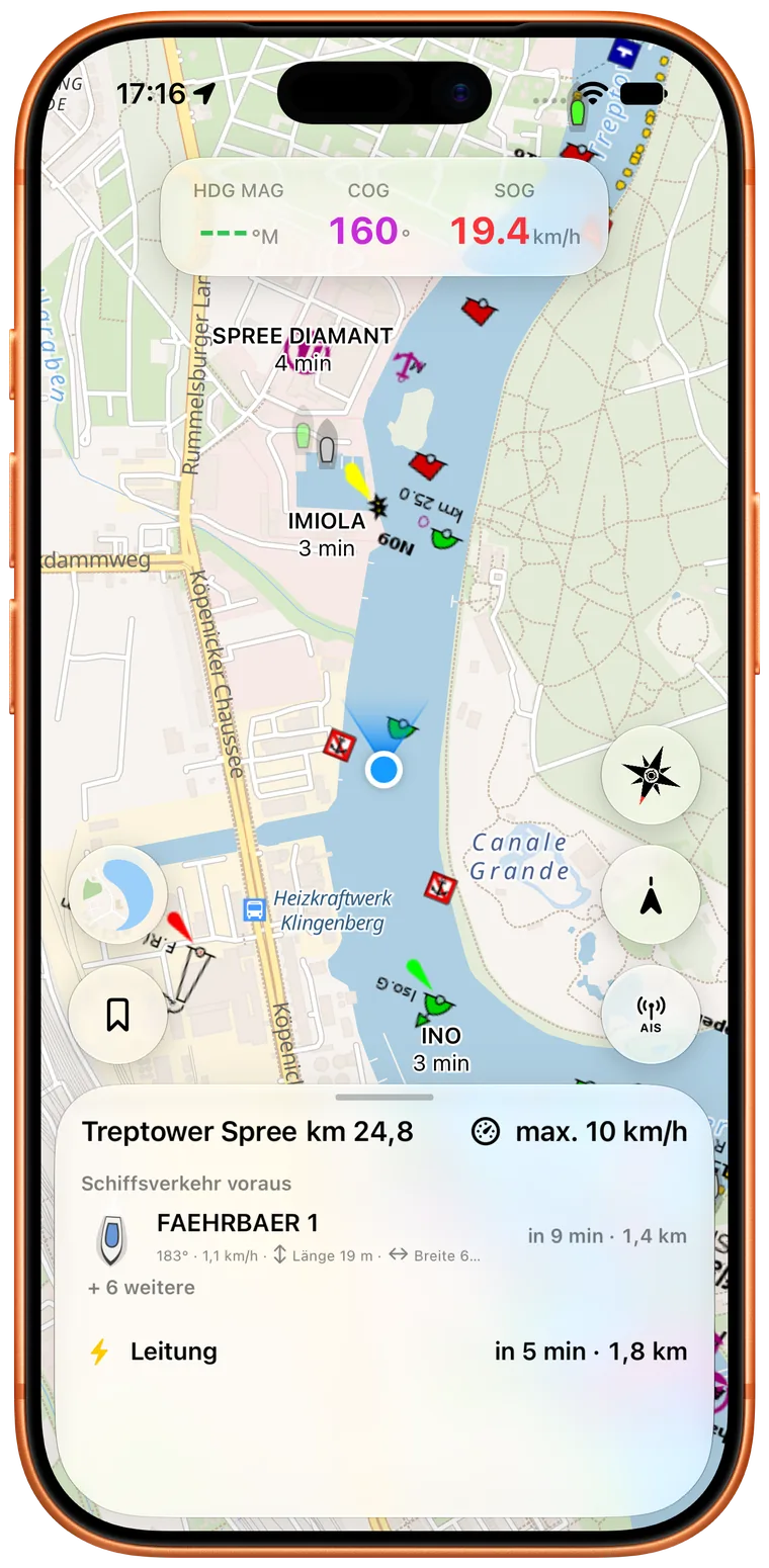
A large vessel around the bend or a crossing ferry appears early as part of the situation on your waterway.
Notices without searching authority portals
Rivers & Seas processes available notices to skippers, connects them to the waterway, and turns them into plain-language information or warnings. Closures, restrictions, and changed operating times appear where they matter for the journey.
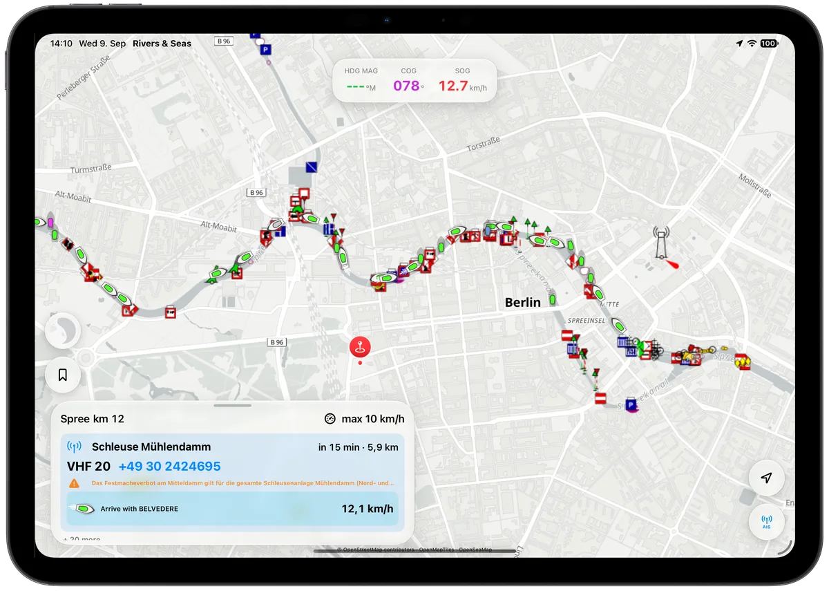
Spend less time waiting at locks
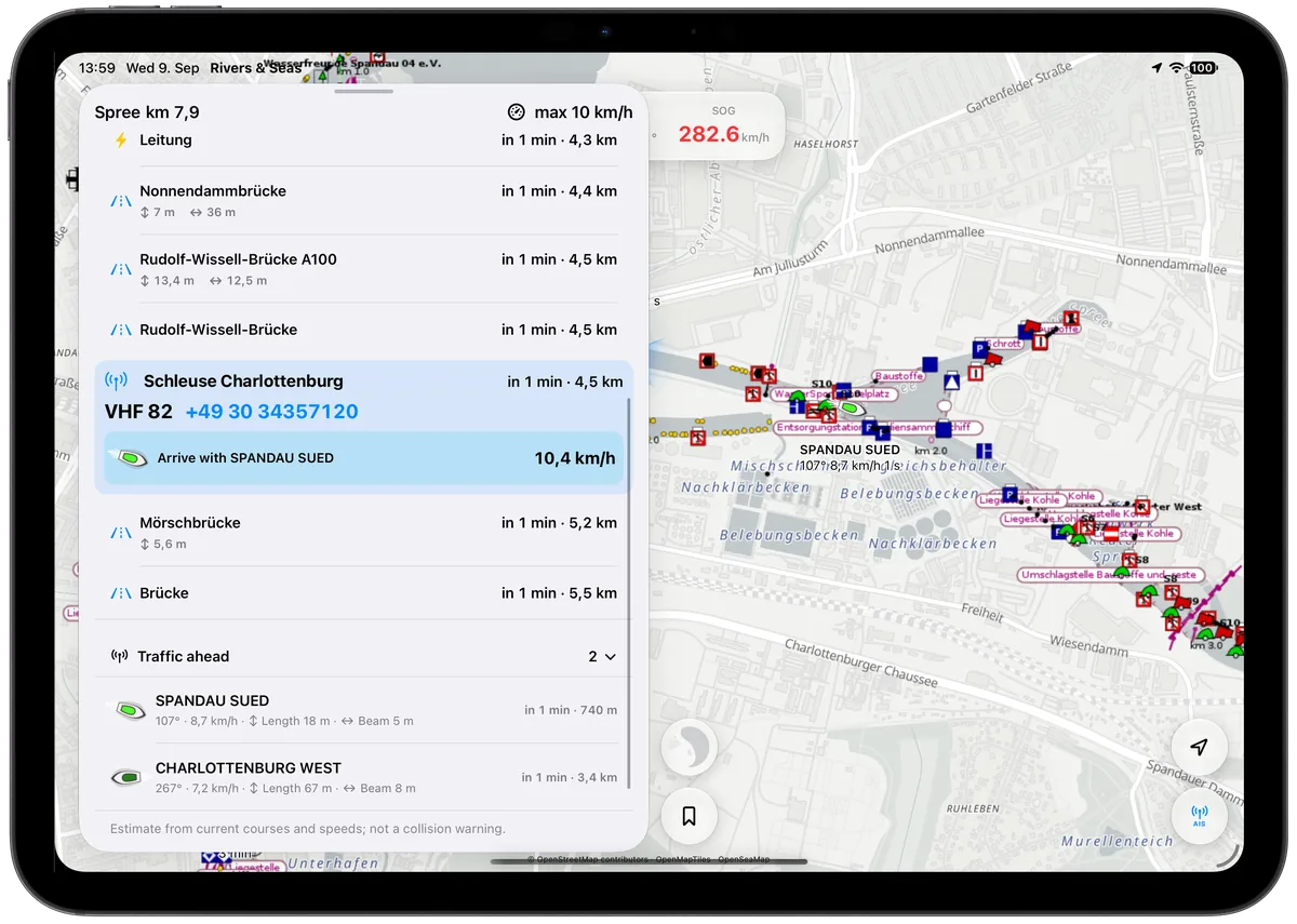
Rivers & Seas automatically compares when you and the commercial vessel will reach the next lock. Alongside VHF and telephone details, you see the speed needed to arrive with that vessel.
Know the structure before you arrive
Bridge photos and dimensions make structures easier to recognize. For locks, available operating times, VHF, telephone, usable length, width, and draft appear together. There is no need to assemble critical details just before arrival.
For inland and coastal cruising
The boating map works worldwide. Rich Waterway Ahead information is being expanded for Berlin and Potsdam, the Mecklenburg Lake District, German rivers and canals, the Netherlands, and France. Tides and coastal charts make Rivers & Seas useful on the way to sea as well.
It all belongs together
The public beta is free. The finished app is planned at one fixed purchase price for every feature and cruising area.
Experience Waterway Ahead
Install the public beta, or try the browser map with real AIS targets first.