
Five questions you can answer in good time
Instead of looking up dimensions, operating hours, tides, and vessel traffic in several places, you get the answers that matter for this journey. That gives you time to make a calm decision before the bridge or lock is close.
Will my boat clear the bridge?
See the available clearance at your expected arrival, including the forecast water level on a tidal waterway.
Will the lock be open then?
The app relates known operating hours and closures to the time at which you are expected to arrive.
How do I contact the lock?
The VHF channel and phone number move forward at the useful moment, so you do not have to search for them.
What is coming towards me?
Moving AIS vessels ahead appear with name, direction, speed, and an estimated meeting time.
Can I join the commercial vessel?
Rivers & Seas can show the speed that would be needed to reach the lock together.
Where to find the view ahead
When the waterway is supported, its panel appears along the bottom of the map while you are underway. It shows the waterway name or kilometre, any known speed limit, and the next important points in your direction of travel.
Pull the panel upwards when you want the fuller picture. Bridges, locks, closures, and moving AIS vessels appear in the order in which you are likely to reach them. Distance and time help you choose when to act.
Bridge clearance for arrival, not merely for now
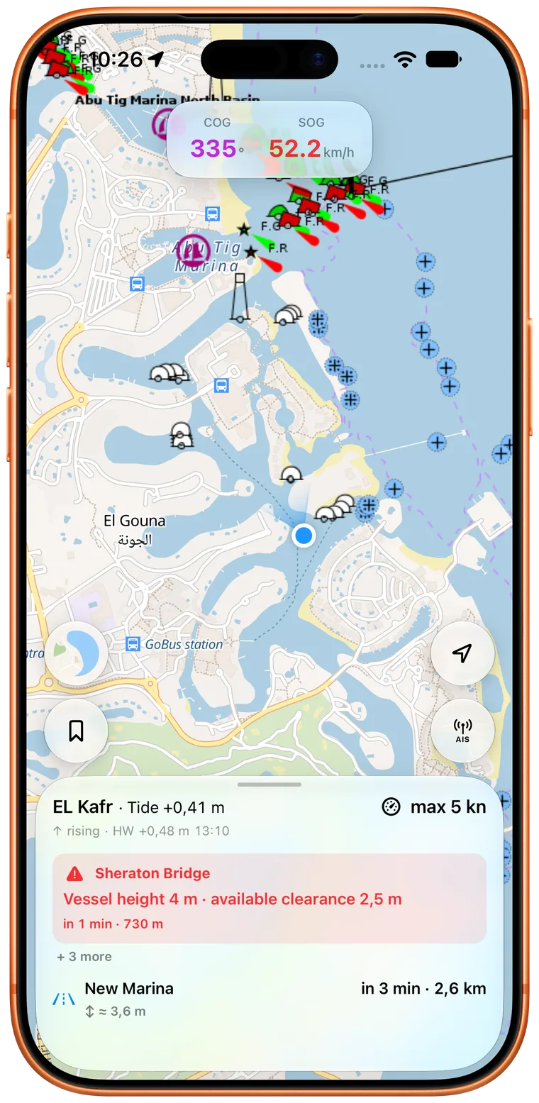
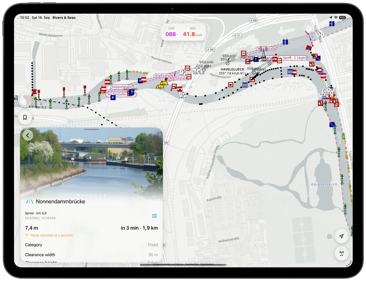
For a bridge, you see the remaining time, distance, and—where known—the available height and width. When Rivers & Seas knows the required dimensions of your boat, it gives a clear warning if the known opening is insufficient.
On tidal waterways, the water level at this moment is only part of the story. Rivers & Seas uses the forecast water level for the time at which you are expected to reach the bridge. A clearance marked ≈ is therefore an estimate. The waterway header also tells you whether the tide is rising or falling and when the next high or low water is expected.
Reach and contact locks in good time
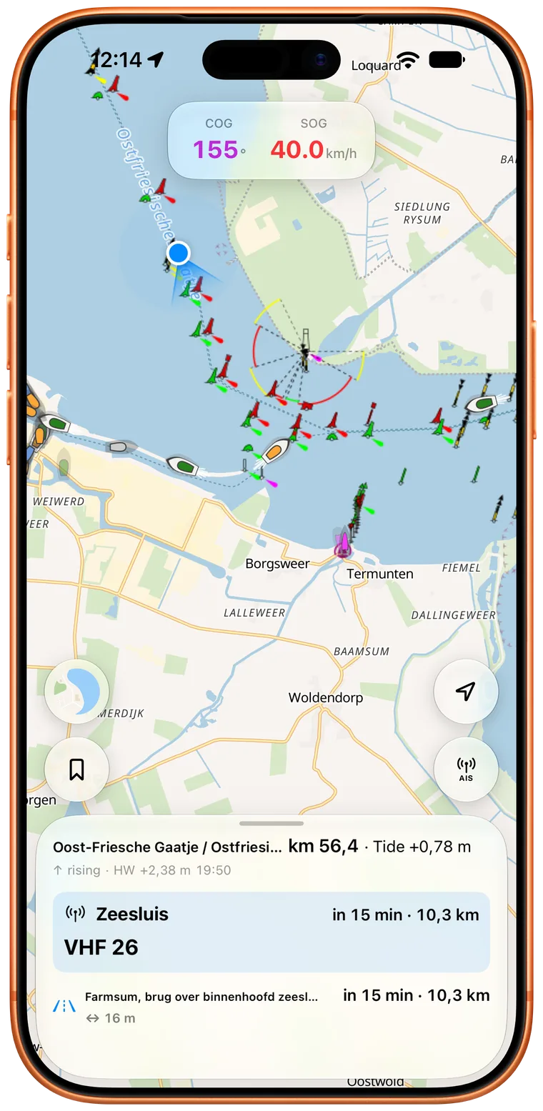
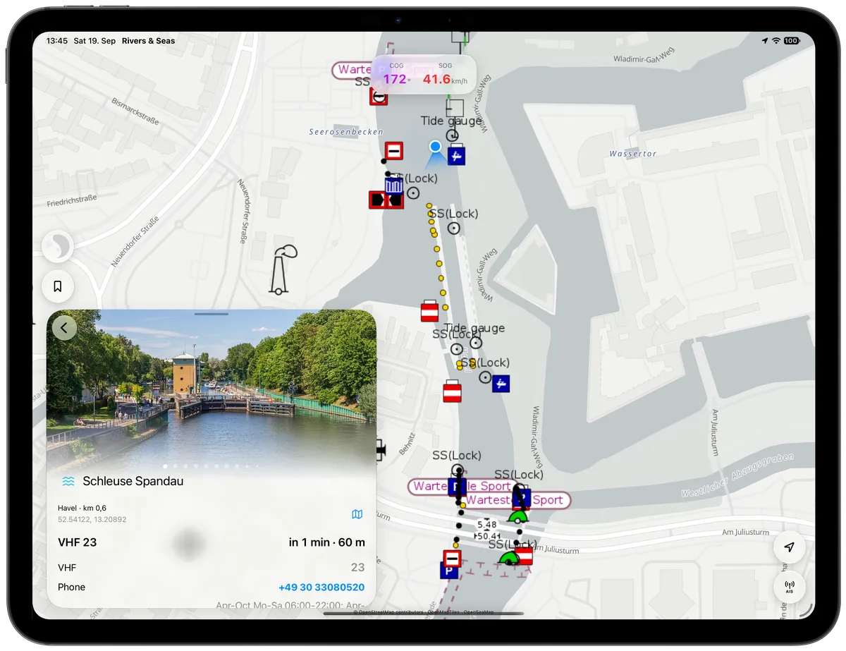
As you approach a lock, Rivers & Seas shows its distance and your estimated arrival. About 15 minutes beforehand, any available VHF channel and phone number are brought prominently into view. Tap the number to call it directly.
When operating hours or a current closure are known, they are assessed for your arrival. The warning is therefore not merely that the lock closes at some point, but that it will be closed or likely closed when you get there. A short expected wait can also be shown.
ELWIS and EuRIS notices appear automatically
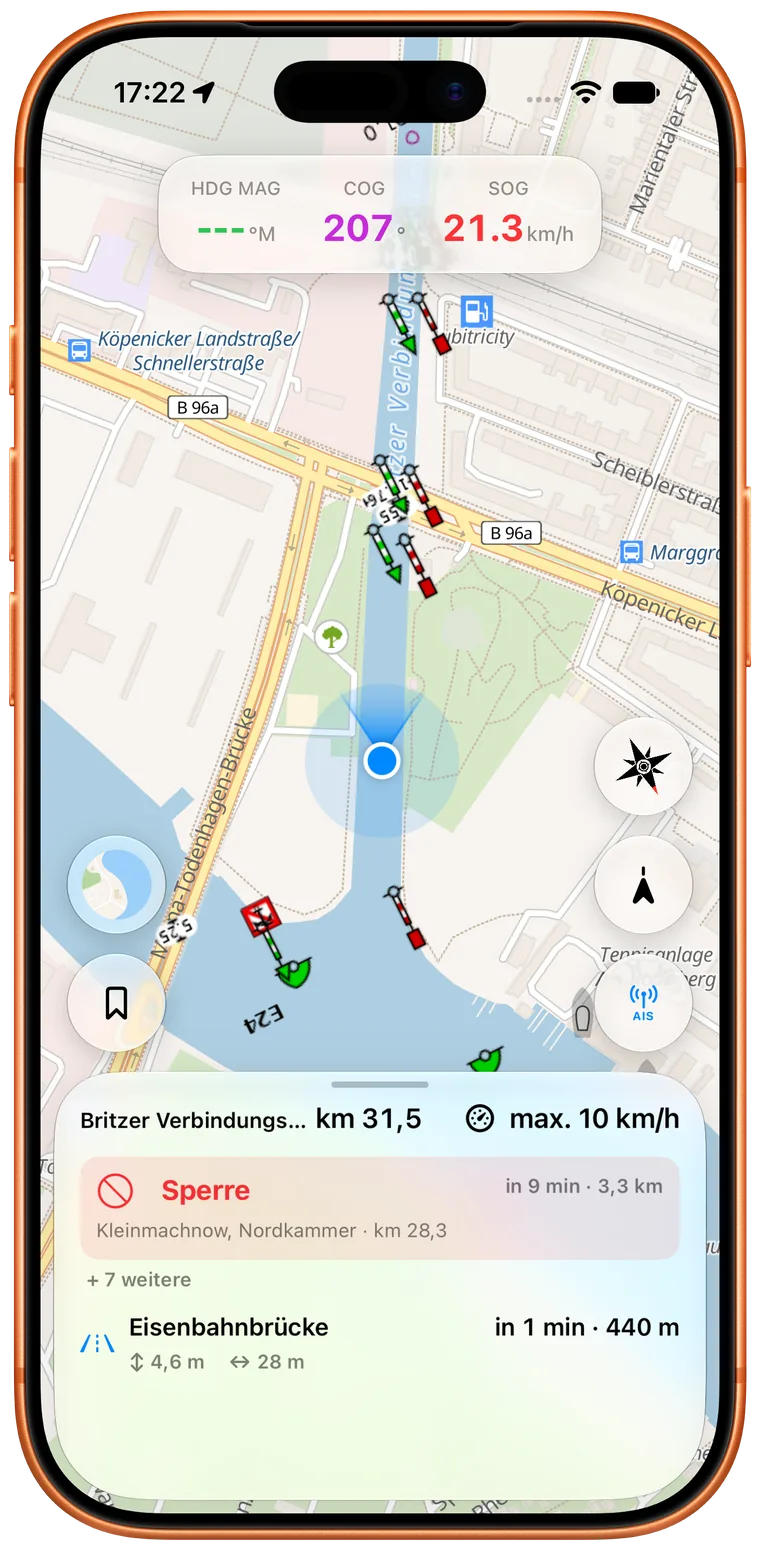
Rivers & Seas fully processes the available notices from ELWIS and EuRIS. You do not have to search those portals while underway: every notice that can be reliably matched to your waterway and direction of travel appears automatically in the right place within Waterway Ahead.
These may include closures, restrictions, and other navigation notices. Rivers & Seas relates time-limited notices to your expected arrival and brings the important part forward. You can therefore see early when a lock chamber or section will not be available when you get there.
Reach the lock with the commercial vessel ahead
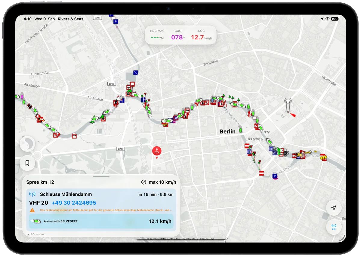
When a commercial vessel is travelling ahead on the same waterway towards the next lock, Rivers & Seas can compare its arrival with yours. With sufficiently recent AIS data, you may see “Arrive with BELVEDERE” and the speed that would be needed to do so.
Get through the lock sooner: a commercial vessel ahead may give you the chance to join the next locking. Beside the lock's VHF channel and phone number, you see the speed you would need to arrive together with that vessel.
See large vessels and crossing ferries in good time
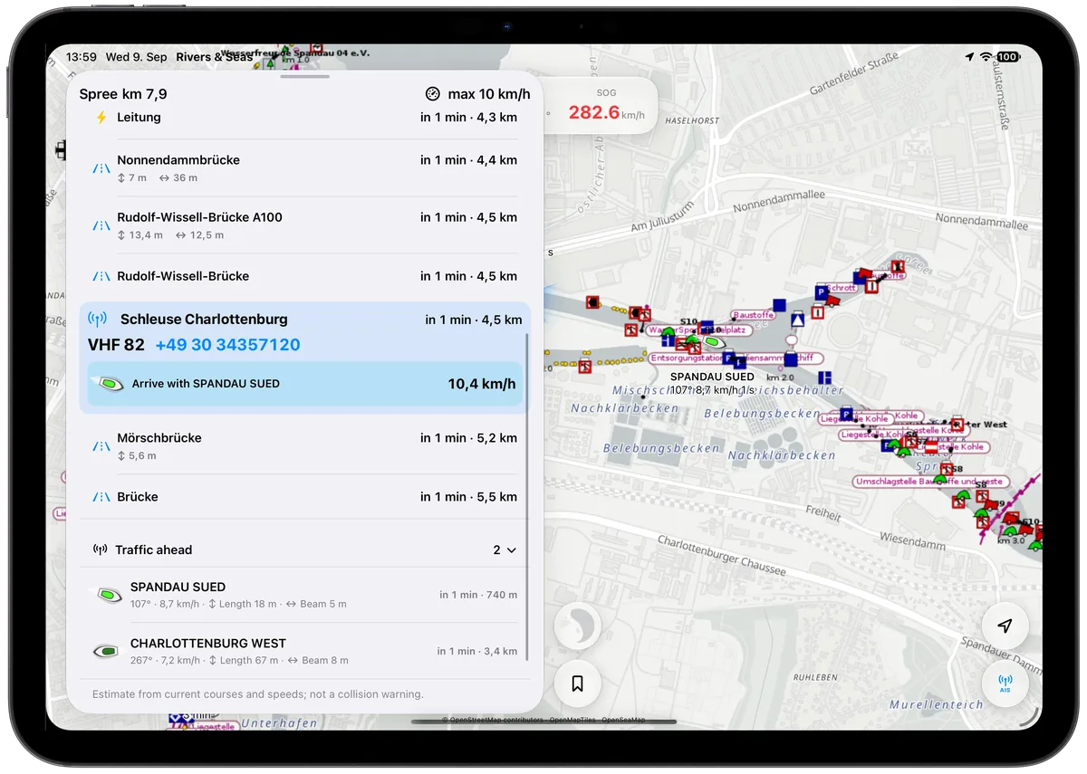
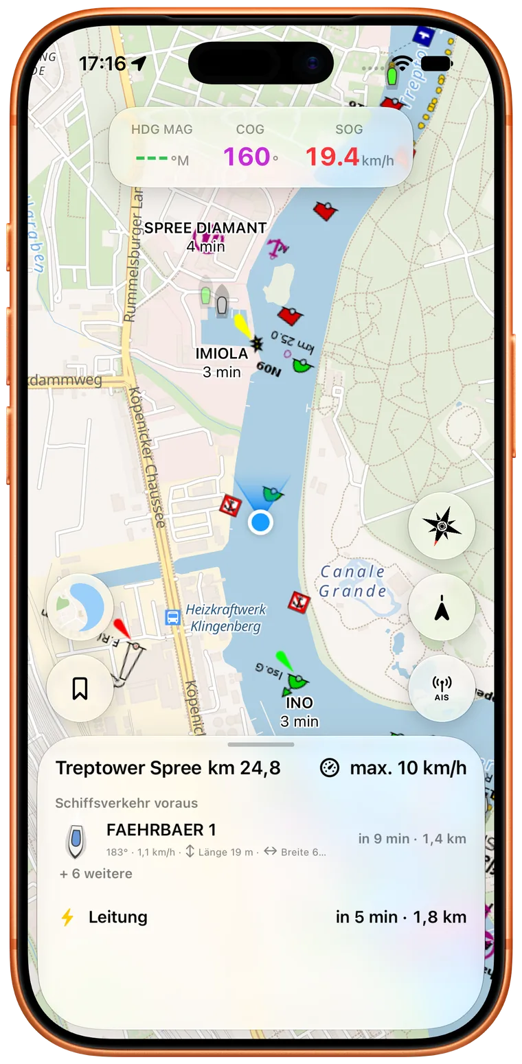
Is a large commercial vessel coming towards you beyond the next bend? Is a ferry crossing farther ahead? Rivers & Seas brings the important vessel traffic into Waterway Ahead in good time. You can slow down early, wait at a clear stretch, or prepare calmly for the encounter.
You see the vessel's name and roughly when you will meet. Course, speed, and—when available—length and beam help you understand the situation. Tap a vessel to open the other available details.
See the bridge or lock before you arrive
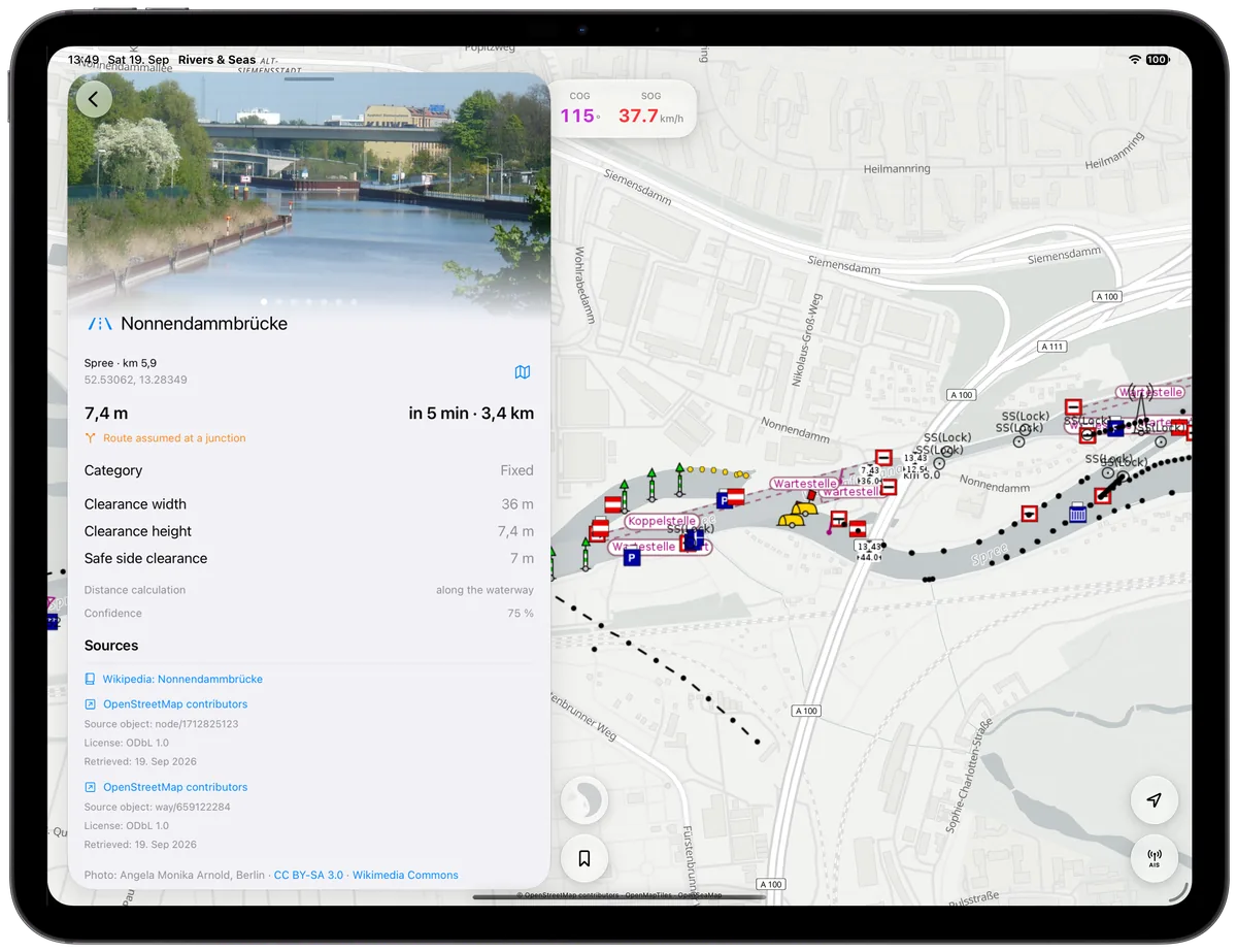
What does the bridge ahead actually look like? How wide is the opening? Rivers & Seas even includes photographs for many bridges and locks, together with available dimensions, operating hours, and the calculated bridge clearance when you arrive.
For locks, the VHF channel, phone number, operating hours, usable length and width, and permitted draught are ready in one place. Tap the item to open every available detail while keeping the map in view.
You remain in command
Waterway Ahead brings together information that would otherwise require several separate searches and relates it to your trip. It gives you an earlier, clearer picture, but it does not replace a proper lookout, navigation rules, signs, radio traffic, or instructions from lock staff.
Slow down early when the situation is uncertain. Check the opening, water level, and operating state as you approach, and always leave enough room to respond to other vessels.