Shore zone and speed
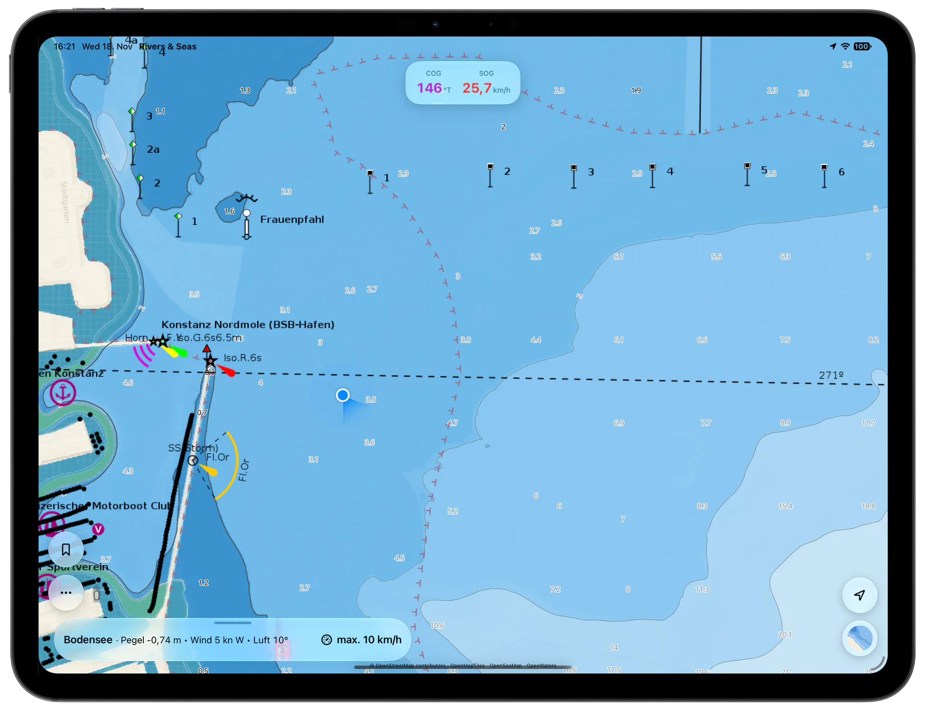
Known shore zones and speed limits appear on the map while your own speed remains visible.
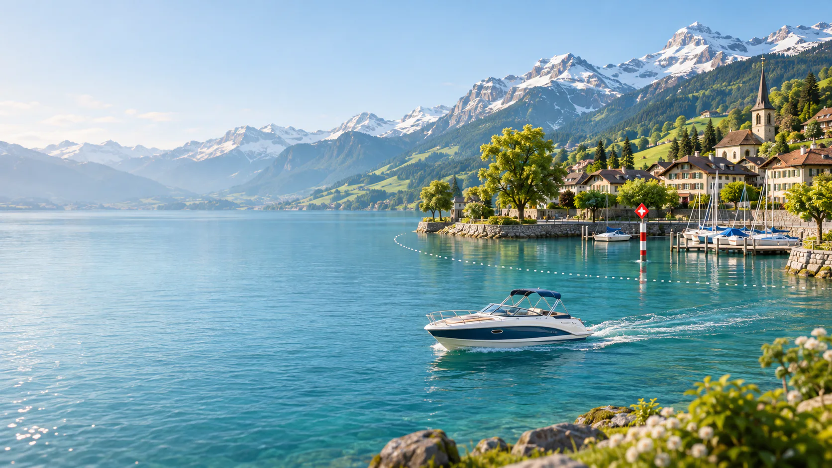
More than a map of the lake
Between the marina, shore zone and open lake, depth and traffic are not the only things that change. Rules and weather change too. Rivers & Seas brings together the information you need before casting off and while underway.
Known shore zones and speed limits appear on the map while your own speed remains visible.
Move through the hourly forecast up to 72 hours ahead and recognise the better weather window for your trip.
Displayed Tracks become your personal safe channel. Distance and arrival time show when you will reach important places.
Shore zones and 10 km/h
On Lake Constance, motorboats and sailing boats under power must generally stay outside the 300-metre protected shore zone. When approaching or leaving shore, they must take the shortest route and remain at or below 10 km/h. Swiss lakes also have shore zones, speed limits and local restrictions whose precise rules can vary by lake and canton.
Rivers & Seas places known zones and restrictions in their map context. You can see not only a number, but where it applies to your journey. Local signs and the current regulations always take precedence.
A 300-metre protected shore zone; permitted approaches and departures use the shortest route at no more than 10 km/h.
Shore zones and local rules can differ by lake, canton and marked zone.
Map, known restriction and your own speed are available together, without one blanket traffic light for every situation.
Weather for your place on the lake
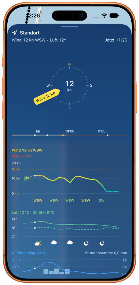
Make your marina, buoy, berth or bay the weather place. Rivers & Seas shows wind, gusts, rain, air and feels-like temperature there, plus water level and water temperature where reliable data are available. Your personal wind limit appears in the forecast and can alert you in the background.
One cruising area, then the next
The waterway map is not restricted to a fixed list. Which depths, zones, water levels, temperatures or weather values are available depends on the data for each lake.
Lake Constance, Lake Geneva, Lake Maggiore and Lake Lugano, including trips that cross a national border.
Lake Neuchâtel, Lake Biel, Lake Murten, Lake Zurich and Lake Zug with saved places, weather and map.
Lake Lucerne, Lake Thun, Lake Brienz and Walensee, where developing wind and personal limits matter especially.
Your experience travels with you
Show your own Tracks or Tracks received from friends on the map. Rivers & Seas combines Tracks marked “Safe to navigate” into your personal safe channel, which is especially useful along shallow shores, between shoals or in a narrow approach to a berth. Along a Track, you can see distance and estimated arrival times for saved places and important points.
Recognise the course that has already worked for your boat or a boat you trust.
Your own and shared safe Tracks can grow into one combined channel.
Distance, travel time and estimated arrival help with meeting points, marina hours and the weather window.
Your places on the lake
Save a place exactly where you noticed it. Photos, notes and coloured tags help you return to the quiet bathing bay, proven anchoring ground or fishing spot, even on a large lake whose shoreline can look deceptively similar.
Add photos, notes, contact details and links directly to the saved place.
Tags such as #anchorage, #bathing or #fishing give related places a colour and make them filterable.
Choose a saved marina or place as the weather place so the app and widgets look ahead there.
Frequently asked questions
Yes. You can use the waterway map, weather forecast, saved places and Tracks on Lake Constance. Known shore zones and speed limits help put your trip into context, while available water-level and temperature data complement the view.
Yes. Rivers & Seas also works on Lake Geneva, Lake Neuchâtel and other Swiss lakes. Which depths, zones, water levels or temperatures appear depends on the data available for each lake.
No. The rules must not be applied indiscriminately to every lake and situation. On Lake Constance, permitted approaches and departures in the 300-metre protected shore zone are limited to 10 km/h. Shore zones and local rules on Swiss lakes can differ, so always observe current signs and the regulations for the lake.
Rivers & Seas is an alternative or complement, especially if you cruise beyond Swiss lakes and want weather, personal wind alerts, widgets, bookmarks and Tracks in one app.
Yes. Choose a saved place as your weather place. The app and widgets then show the forecast for that place while you are still at home. Without a fixed weather place, the display returns to your current position.
Rivers & Seas runs on iPhone and iPad as well as Macs with Apple silicon. Weather is also available through Home Screen, Lock Screen and StandBy widgets.
Before you next cast off
Install the free beta and try Rivers & Seas on your lake.